Kent
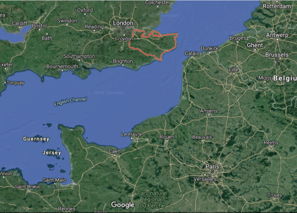
Kent has a population of approximately 1.6 million people. Its close proximity to London and the continent, with a highly varied landscape and a long coastline, results in very diverse communities. Some coastal towns have high levels of unemployment, deprivation, and vulnerability, often with aged populations. Many areas are experiencing increased flooding, expected to get worse due to rising sea levels and changing weather due to climate change.
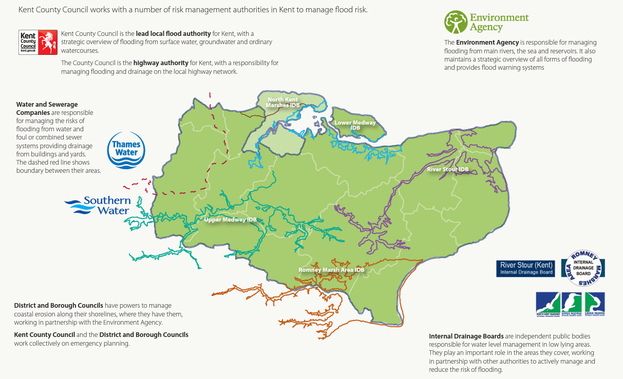
Kent County Council is the Lead Local Flood Authority (LLFA) for Kent. As the LLFA they have an overview role for local flooding. Local flooding is flooding that arises from the following sources: surface runoff, ordinary watercourses, and groundwater. The flooding from these sources is generally more localised than flooding from rivers and the sea. Managing these forms of flooding often relies on several systems working effectively, especially drainage networks, sewers and ordinary watercourses, which may be managed by different authorities. Cooperation and integrated planning is required from these authorities to manage local flooding effectively. There are many authorities involved in the management of local flooding in Kent, including Kent County Council, the Environment Agency, District and Borough Councils, Internal Drainage Boards and Water Companies. As the LLFA, Kent County Council produces a Local Flood Risk Management Strategy that sets out how local flood risks is being managed in the county by the authorities involved.

Climate Change Impact
Climate change has the potential to increase current and future risk from flooding. Climate change is likely to affect flood risk through sea level rise, more frequent and higher storm surges, increased winter rainfall, drier summers with periods of more intense summer rainfall. These effects are likely to result in increased frequency and magnitude of flooding in Kent. As such, there is clear need and demand to take proactive action to reduce current and future impacts of flooding. Local flood risk in particular is likely to be affected by climate change from :
- increased rainfall volumes in the winter leading to more fluvial flooding, including ordinary watercourses high levels on rivers can reduce the ability of ordinary watercourses and drainage networks to discharge
- increased rainfall volumes in the winter leading to more fluvial flooding, including ordinary watercourses high levels on rivers can reduce the ability of ordinary watercourses and drainage networks to discharge
- increased rainfall can lead to significant groundwater recharge, which can cause groundwater flooding
- sea-level rise will affect the ability of coastal rivers and drainage networks to discharge These factors, as well as other consequences of climate change, need to be included in the delivery of flood risk management works.
These factors, as well as other consequences of climate change, need to be included in the delivery of flood risk management works. The Local Flood Risk Management Strategy (Kent Local Strategy) seeks to identify opportunities to deliver multiple benefits (environmental and societal), such as providing habitat to enhance te environment, supporting communities to improve their resilience, and improve the local landscape character.


Flood Risk
There are approximately 64,000 properties estimated to be at risk of flooding from coastal and fluvial flooding in Kent. The coastal areas of Kent are at significant risk of flooding, in particular the Romney Marshes, Dartford and Gravesend are at high risk of coastal and tidal flooding. Flood defences are in place in many of these areas to reduce the risk. The floodplains of the Rivers Medway, Beult, Stour and Darent present a significant risk of fluvial flooding in Kent, there are some flood defences for these areas. There are also approximately 24,000 properties estimated to be at risk of flooding from surface runoff. This is one of the highest risks of any Lead Local Flood Authority in England. All areas are at some risk of surface water flooding, but the risk is generally concentrated in urban areas. Ordinary watercourses are a significant source of flood risk in Kent, unfortunately there is no national estimate of the risk from this source. Ordinary watercourses can vary in size from small ditches or field drains to large streams or small rivers. There are towns and villages in Kent with steeper topography, where ordinary watercourses present a significant flood risk. Groundwater presents a significant source of flooding in parts of Kent as there are large areas of permeable aquifers, particularly the chalk aquifers of the North Downs. Groundwater flooding occurs in a number of areas across the North Downs.
Pilot site activities
- Several independent Flood Action Groups (FAGs) have been created by the National Flood Forum in Kent, and the National Flood Forum will build on these to pilot climate change adaptation approaches, whilst three new groups will be formed in deprived coastal areas, testing methodologies in more complex settings
- The aim is to create a Kent Resilience Network of Flood Action Groups. FAGs and networks will work with their communities to understand their flood risk.
- They will collaboratively create locally specific actions (such as capital projects) and respond to incidents. Networks will create social learning, build relationships with stakeholders, create projects with partners and build capacities to better manage flood risk.
- An interactive mapping pilot will be a citizen led approach to gathering local flood risk evidence that can be used proactively to help reduce flood risk and adapt to climate change.


Main outputs
- The National Flood Forum will build upon our work with communities and partners in Kent, with support from Kent County Council.
- We will focus on setting up three new Flood Action Groups in coastal areas, building a network of Flood Action Groups across the county (Kent Resilience Network) and piloting the use of community-led, web-based interactive maps, which can add to the local risk maps and flood action plans used by the community to improve decision-making.
- We will also be contributing to each of the wider project elements, sharing and learning with each of the project partners in France and England to develop new and better approaches for community-led approaches to flood risk management.
For more details on our activities and ongoing actions in this pilot site, please visit our Interreg-BRIC web platform bric-network page :
Collaborators


