![]()
![]()
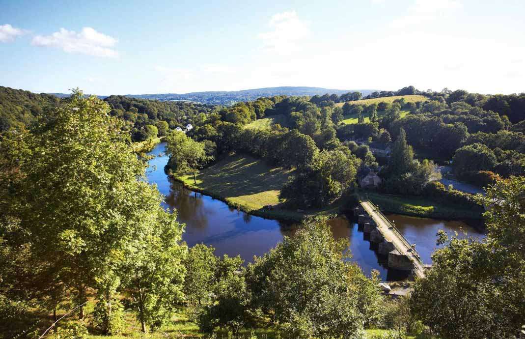
Dans le cadre du projet BRIC, parmi les actions menées sur le site pilote de la vallée de l’Aulne, le Cerema expérimente, grâce à l’appui d’Ogoxe, l’outil cartographique story map pour sensibiliser et impliquer la population locale aux inondations.
La story map est un outil cartographique web disponible sur plusieurs applications comme Esri Story map. Elle est définie comme une forme de fil narratif qui combine des cartes, du texte, des photographies, des vidéos, des audios, etc. Elle permet aux utilisateurs de raconter une histoire avec des cartes et des outils multimédias, de manière dynamique et interactive.
L’incorporation de ces médias a notamment pour but de rendre le récit plus attractif. Ainsi, cette présentation particulière permet au lecteur de suivre la progression du récit et de le spatialiser.
De plus, la story map peut être utilisée dans tous les domaines comme un support de
présentation, de communication et de diffusion d’informations. Elle est également adaptée à
n’importe quel sujet. La story map peut raconter un voyage, l’écosystème d’une rivière ou
encore des évènements marquants comme la reconstruction des habitants après une tempête.
Elle peut aussi s’insérer dans un processus thérapeutique ou de mémoire, lorsqu’il s’agit de
récits à dimensions tragiques comme cela peut être le cas après des risques inondations.
Dans ce projet, la story map a pour objectif:
• de partager des connaissances de manière positive et éducative sur le territoire de
l’Aulne et de ses inondations.
• de fédérer autour de l’Aulne un marqueur emblématique du territoire.
Concrètement, à travers les cartes interactives, les images, les audios et les témoignages
recueillis lors d’entretiens et d’enquêtes avec les habitants et les acteurs locaux du territoire, la story map invite le lecteur à se remémorer, à se questionner sur son territoire et à participer au récit. Basé sur le vécu des habitants elle suscite aussi les émotions par les ressources qu’elles mobilisent.
La story map réalisée sur le site de l’Aulne, s’articule autour de quatre parties intitulées :
• Au fil de l’eau et du temps
• L’eau, la terre et le ciel
• Les trésors cachés
• Les perspectives du territoire.
Les deux premières parties sont dédiées à informer, à sensibiliser les habitants à travers la présentation du fleuve de l’Aulne, de l’histoire du canal de Nantes à Brest et des spécificités du territoire (fleuve, agriculture, les milieux naturels, l’urbanisation, les inondations). Les deux parties suivantes s’appuient sur des témoignages, des anecdotes, permettant de représenter l’expérience vécue, les sentiments et les questionnements des habitants et des acteurs locaux au sujet de leur environnement, des inondations et du changement climatique.
Si vous habitez la vallée de l’Aulne et que ce projet vous intéresse, n’hésitez pas à accéder à la story map disponible sur la plateforme Interreg-BRIC – Renforcer la résilience des communautés: https://vallee-aulne.bric-network.com/partner-app/storymap
The story map: a tool to raise awareness about the Aulne floods
A story map tool has been produced for the Aulne Valley pilot site, by BRIC partners Cerema, with the support of Ogoxe, to raise awareness about flood risk with the local population.
A story map is narrative thread designed on a web page that combines elements such as maps, text, photographs, videos and audios. It allows users to tell a story with maps and multimedia tools in a dynamic and interactive way in a more attractive way.
It allows the reader to follow the progression of the story and to spatialise it.
The story map can be used in all fields as a presentation, communication and information dissemination medium. It is also suitable for any subject. The story map can tell the story of a journey, the ecosystem of a river, or of significant events such as the reconstruction of the inhabitants after a storm. It can also be part of a therapeutic or memory process, when it comes to stories with a tragic dimension, such as after floods.
In this project, the story map aims to:
- Share knowledge in a positive and educational way about the territory of the Aulne and its floods.
- To unite people around the Aulne, an emblematic marker of the territory.
In concrete terms, through interactive maps, images, audio recordings and testimonies collected during interviews and surveys with the territory’s inhabitants and local actors, the story map invites the reader to remember, to question his or her territory and to participate in the story. Based on the experience of the inhabitants, it also arouses emotions through the resources it mobilises.
The story map produced on the Aulne site is structured around four parts entitled:
- Over the course of water and time
- Water, earth and sky
- Hidden treasures
- The perspectives of the territory.
The first two parts are dedicated to informing and raising the awareness of the inhabitants through the presentation of the Aulne river, the history of the Nantes-Brest canal and the specificities of the territory (river, agriculture, natural environments, urbanisation, flooding).
The next two parts are based on testimonies and anecdotes, allowing to represent the lived experience, the feelings and the questioning of the inhabitants and the local actors about their environment, the floods and the climate change.
The story map can be viewed here: https://vallee-aulne.bric-network.com/partner-app/storymap
I’m amazed by your remarkable ability to transform ordinary subjects into compelling content. Well done!