![]()
![]()
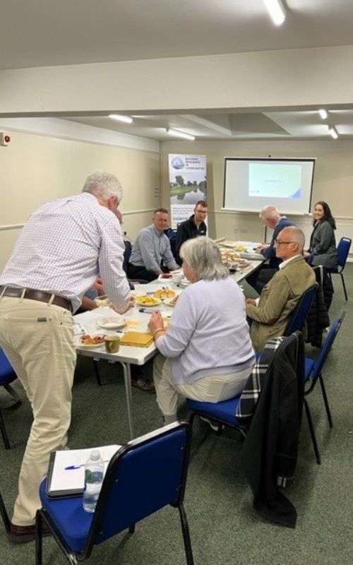
The Kent Resilience Network hosted their first ever in-person meeting at the Aylesford Community Centre near Maidstone on Thursday 27th October. The network invited not only its core members, but members of other Flood Action Groups and interested parties.
Introducing the KRN
Chair of the Kent Resilience Network, David Goff, opened the meeting with an introduction to the KRN, elaborating on the group’s foundations, their commonalities, and strategic objectives.
“The Kent Resilience Network came about through the need for more joined-up thinking.”
The Kent Resilience Network was formed in order to give a voice directly to the communities in the world of Flood Risk Management in Kent. Initially, representatives from 6 Flood Action Groups formed the network: Hildenborough, Collier Street, East Peckham, Headcorn, Tunbridge Wells and Ightham. The Network aims to promote effective communication and collaboration, identify priorities and commonalities, understand roles and responsibilities in flood risk management and gain representation for communities on a more strategic level. The common issues identified across Kent include a lack of joined-up thinking, riparian ownership, local policy and planning processes, surface water drainage infrastructure and funding.
The BRIC Project
The National Flood Forum gave an overview of the BRIC project, including outlining the wonderful work that all project partners are contributing. More in-depth presentations and updates were given on the creation of the Kent pilot-area StoryMap and the ongoing Community-led Mapping Pilot that the Collier Street Flood Action Group is taking part in.
The Network had several ideas for what to include in the StoryMap, such as information about historic flooding events, and on planning and development issues.
The Network also learned of the Community-led Mapping Pilot, which aims to allow the community to work in collaboration with Flood Risk Management Authorities to keep an up-to- date digital record of flood risk assets and problematic locations. When the transition from paper to digital records took place within the Council, data and information was lost. For example, it was found that the Council Highways team only had records of 7 drains in one particular street, when at least 14 existed. Collier Street Flood Action Group have a collection of detailed paper maps that contain vast amounts of information and data on everything from the network of drainage ditches in the village to the locations of permissive road closures that can be implemented in the event of a flood. Often, there is only one such copy of any paper map, so by digitising the information, it can be accessed by not only members of the Flood Cation Group but the Flood Risk Management Authorities too.
Initially, the Flood Action Group members were concerned by the technology involved in creating such a map, but all members were keen to get involved in collecting data. For example, each group member walked their own street and marked on a paper map the locations of all drains. The group then sat down with the NFF officer to transfer this onto the digital map.
Also included on the map are unregistered ponds that exist in the village, the river and surface water flood risk zones and blocked drainage ditches. The next steps for the group are to meet with the Risk Management Authorities to share information that will be useful for including on the map.
“Undertaking to map all of our drains, and share that information with the Council, seems like a very sensible idea”
The KRN were impressed with the progress, and with the initiative as a whole. Members inquired about replicating the pilot in their own areas and were pleased to hear that the National Flood Forum would be able to assist with this.
Flood Issues in Kent
The group shared stories about their own areas, and the problems that they have faced in the past, ongoing issues, and what they hope can be addressed in the future. Key themes of the discussion including planning and development, riparian ownership, reporting concerns and funding.
One important factor raised was the cumulative impact of planning decisions on areas that border different planning authorities. With farmers being incentivised to sell their land, either for housing developments or solar farms, this change of land use can have a dramatic impact on surface water flooding in surrounding areas without adequate mitigation, for example in the form of Sustainable Drainage Systems. This links to funding in that the relevant planning authorities have limited staffing and resources to be able to inspect development to check that developers are meeting the terms of their planning permission with regards to drainage.
The possibility of ring-fencing funding for Section 106 planning obligations for ‘betterment’ was raised, so that money is spent directly on areas that are disadvantaged by developments as opposed to elsewhere in the district or borough.
The Next Steps
One member described the Kent Resilience Network as pushing a big boulder.
“It takes a lot of work to get it moving, but once it starts rolling, it will be difficult to stop.”
The points and commonalities raised at the meeting can be raised with the relevant Risk Management Authorities, including the Flood Risk Manager in Kent who wishes to know what the group would like from him.
A case for more community-led mapping projects can be made if there is evidence that they are successful and worthwhile to both the communities and Risk Management Authorities.
The group agreed to meet on a more frequent basis to keep the Network moving, and the newly expanded group will meet online before Christmas before meeting again in-person in January.